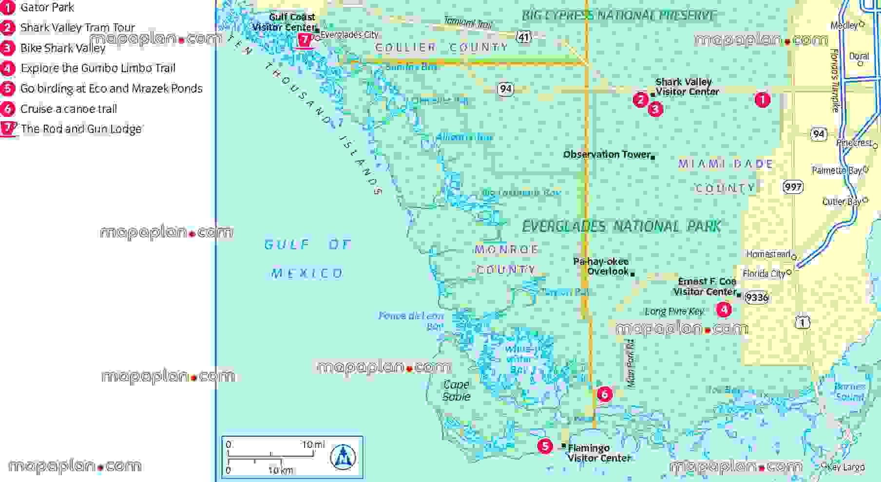
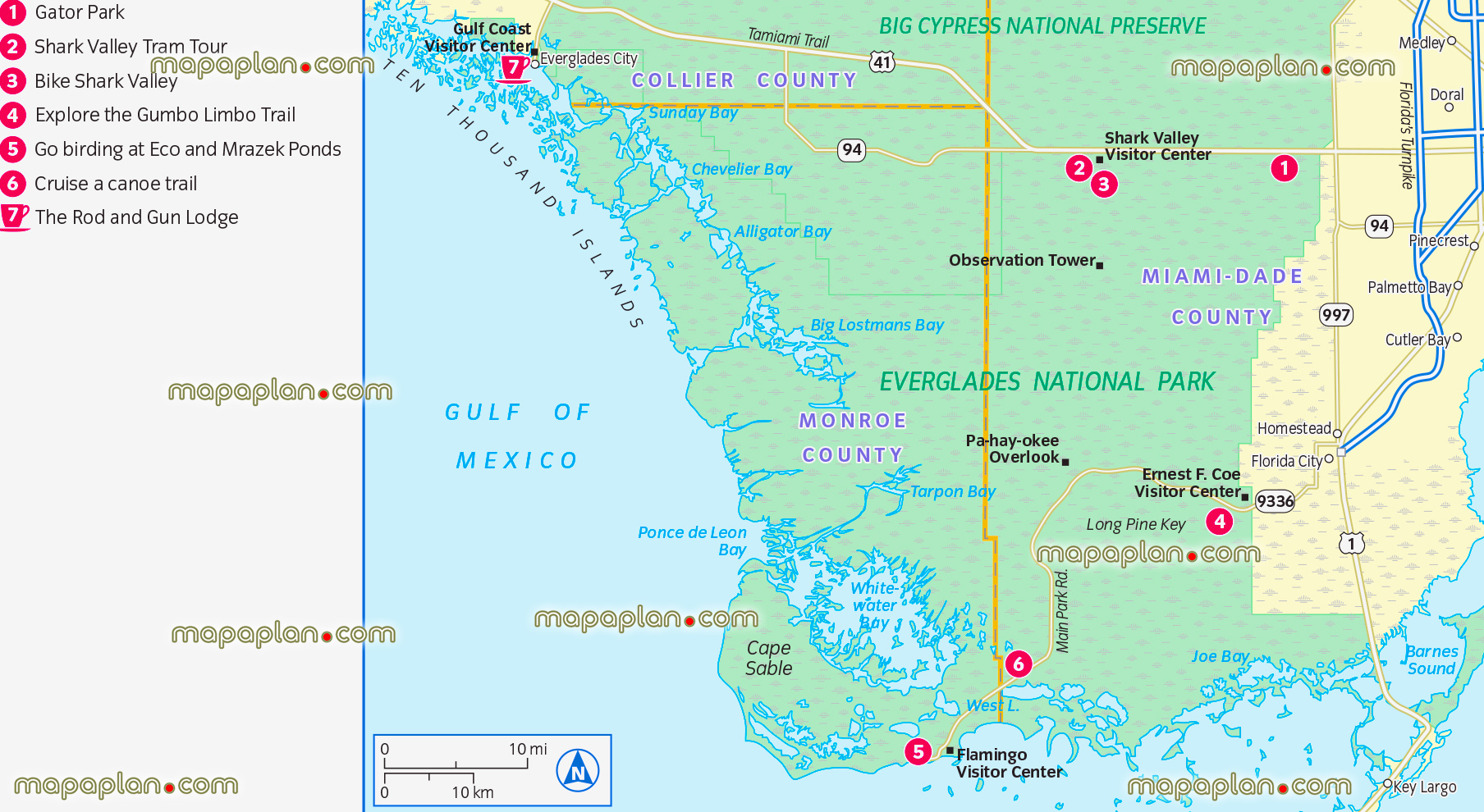
Florida Everglades National Park detailed map showing Gator Park, Shark Valley Tram Tour, Gumbo Limbo Trail, Eco & Mrazek Ponds, Canoe Trail - South Florida and Miami greater metropolitan area downloadable map - City-break historical and natural places to visit plan with neighbourhoods, main locations to visit - Miami top tourist attractions map - High resolution

How can I locate key tourist attractions on the map of Miami?
Our city maps are designed to be user-friendly and interactive. You can easily navigate by panning, zooming in, or zooming out on the high-quality map to find prominent tourist attractions. Each map clearly identifies important landmarks, making it straightforward to discover the sights you're most eager to visit, whether it's a renowned monument, museum, or another point of interest.
Is there a way to see the area surrounding Miami?
In some cities, we offer a general overview of the areas surrounding popular landmarks. While this image doesn't provide a precise street-level view, it gives you a good sense of the neighborhood's layout, showing how the attractions are positioned in relation to other nearby landmarks or points of interest around Miami.
Can I access maps for both tourist spots and other points of interest?
Absolutely! Our platform features maps that showcase not only major tourist attractions but also other important spots such as parks, dining options, and entertainment venues. Whether you're planning to explore a museum or looking for a nearby green space, our maps are designed to help you locate the best destinations in the city with ease.